
Aug. 26 2012
I was ready to go at about 1:00.

I called Amber to see if she had already left town.
I got a return call and we decided that we would caravan (if you can call a motorcycle and a suburban a caravan) to Thompson Falls.
We met up at Jack in the Box and left about 2:00pm.
I lead at first, as we were going via Bovill and St. Maries.
We stopped in Santa, just for a second, where I was instructed that we needed to stop somewhere with a restroom.
We stopped at "The Dog House" in Flat Creek, for the said restroom.
We continued on to St. Maries, where we stopped to get fuel.
Then on the road again towards I-90.
We stopped at the entrance to the freeway (Conoco) because the kids needed some water.
Also, at this point, Amber took the lead.
The freeway was uneventful.
We did see some deer on the other side of Thompson Pass.
 Once we reached Thompson Falls, I helped Amber unload her rig.
We also move the rabbit cage, since they had eaten all the grass around where it was.
I was also asked to help switch out the washer, which I did.
Once we reached Thompson Falls, I helped Amber unload her rig.
We also move the rabbit cage, since they had eaten all the grass around where it was.
I was also asked to help switch out the washer, which I did.
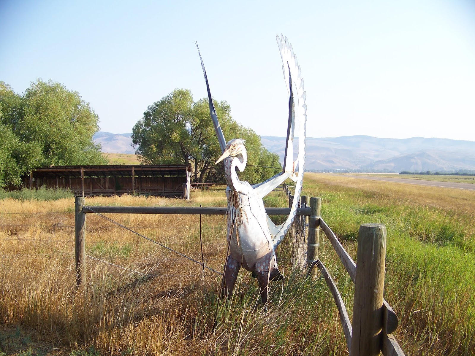
Akery seemed to think it was pretty neat to have my big bike at her house, so I got a picture.
And that pretty much covers the events of the first 1/2 day of my trip.
Aug. 27 2012
I had planned for a later start for this day.
I helped get the kids breakfast and get ready to leave.
Amber and the kids were leaving a little after 10:30 as I was putting on my last layers and getting on the bike.
 I headed south on my way to Philipsburg.
I stopped for a moment and the edge of Paradise to take a picture.
(No, I'm not hiding behind the bike, I'm just leaning on my stuff.)
I figure that I better, since I'm sure this is the only way I'll make it there.
I also removed a few items.
Since I started later, it was already starting to get warm.
I headed south on my way to Philipsburg.
I stopped for a moment and the edge of Paradise to take a picture.
(No, I'm not hiding behind the bike, I'm just leaning on my stuff.)
I figure that I better, since I'm sure this is the only way I'll make it there.
I also removed a few items.
Since I started later, it was already starting to get warm.
I stopped for fuel just before getting on to I-90, then, on to Philipsburg.

 I ate lunch at "Doe Brothers Restaurant".
I had a Vanilla Soda float with Huckleberry ice cream.
Which would have been better if the vanilla soda was cold.
The server asked how it was and that she had never made that concoction before.
For the actual meal, I had a Huckleberry BBQ Pulled Pork sandwich with onion rings.
It was pretty good.
I ate lunch at "Doe Brothers Restaurant".
I had a Vanilla Soda float with Huckleberry ice cream.
Which would have been better if the vanilla soda was cold.
The server asked how it was and that she had never made that concoction before.
For the actual meal, I had a Huckleberry BBQ Pulled Pork sandwich with onion rings.
It was pretty good.
 After lunch, I went across the street to "The Sweet Palace".
Wow... If I wasn't on my bike I probably would have gotten some of the chocolate stuff, but it would just melt on the bike.
They sell the candy by the pound.
You get a bag and fill it and then they weigh it when you check out.
I did get a little over a pound of salt water taffy/flavored caramel/hard candy type.
Then I had to squeeze it onto the bike.
After lunch, I went across the street to "The Sweet Palace".
Wow... If I wasn't on my bike I probably would have gotten some of the chocolate stuff, but it would just melt on the bike.
They sell the candy by the pound.
You get a bag and fill it and then they weigh it when you check out.
I did get a little over a pound of salt water taffy/flavored caramel/hard candy type.
Then I had to squeeze it onto the bike.


I was just getting on the bike, going to go to Granite the ghost town, when these huge drops of water started falling from the sky.
But, that didn't stop me, I started on my way.
I did get out of the rain as I got to the road to Granite.

 Now, I expected a dirt road, but this road...
I must again say, Wow...
On this bike... With this load...
It got narrow, with pot holes and run off gullies, and a very steep drop off.
Had I known, I might have skipped it.
Although the sign does give you a hint, but I was already around the corner before I had processed what the sign said.
But, it did make for an adventure.
And as Scott might say... It's not a real trip if you don't have at least one unexpected adventure.
Granted, that was back before Scott got old. He may not think that way anymore.
Now, I expected a dirt road, but this road...
I must again say, Wow...
On this bike... With this load...
It got narrow, with pot holes and run off gullies, and a very steep drop off.
Had I known, I might have skipped it.
Although the sign does give you a hint, but I was already around the corner before I had processed what the sign said.
But, it did make for an adventure.
And as Scott might say... It's not a real trip if you don't have at least one unexpected adventure.
Granted, that was back before Scott got old. He may not think that way anymore.


 Once off the mountain, I headed towards Anaconda.
Brad A. told me about the Smelter stack and said he couldn't believe I hadn't seen it from the freeway.
(Back when I use to go to and from Wyoming that way.)
So, I went and took some pictures... I don't know what he's talking about.
It barely reaches past my wrist.
Ok, ok... If we fix the camera angle... But it's still not as tall as me.
Once off the mountain, I headed towards Anaconda.
Brad A. told me about the Smelter stack and said he couldn't believe I hadn't seen it from the freeway.
(Back when I use to go to and from Wyoming that way.)
So, I went and took some pictures... I don't know what he's talking about.
It barely reaches past my wrist.
Ok, ok... If we fix the camera angle... But it's still not as tall as me.


I had noted a couple campgrounds to check out for the night. I stopped at one, but wasn't crazy about it, so I kept going. There is a dam along this stretch of road. The steam that comes out of the dam, goes back into the mountain and out the other side into a water cascade down the hill. I stopped to take a few pictures of this cascade.
Looking down from the top>

Looking up from across the way>


 Then not too far down the road, I found the campground where I made camp.
There was a sign that said, if the siren goes off, get out and to higher ground.
Let's just say, I made it through the night and slept ok, but I don't know if I could sleep there night after night with that warning hanging over my head.
Once camp was setup and supper was eaten, I got out the laptop and loaded the pictures I had taken onto it.
There were a few deer that wandered by camp while I was eating.
I also wrote down some notes from the day, so I wouldn't forget something when it came time to put this story together.
I did write it quick, because it was threatening rain, and I wanted to be in the hammock before it started.
Then not too far down the road, I found the campground where I made camp.
There was a sign that said, if the siren goes off, get out and to higher ground.
Let's just say, I made it through the night and slept ok, but I don't know if I could sleep there night after night with that warning hanging over my head.
Once camp was setup and supper was eaten, I got out the laptop and loaded the pictures I had taken onto it.
There were a few deer that wandered by camp while I was eating.
I also wrote down some notes from the day, so I wouldn't forget something when it came time to put this story together.
I did write it quick, because it was threatening rain, and I wanted to be in the hammock before it started.
Aug. 28 2012
Well, it did sprinkle a little once during the night, but nothing major.
I got up at about 6:45 and went to use the restroom.
I came back to a camp full of deer.
They didn't seem too bothered by me and went about their business while I went about mine.
I finished breaking camp and loading the bike.
Then, I headed back towards Philipsburg.
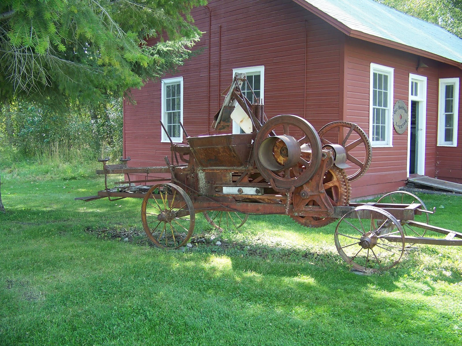
Just north of Philipsburg, I stopped at the Ohrmann Museum and Gallery.
I took several pictures while looking around.


I once again hit the road, going north until I reached Drummond.
Instead of getting on the freeway, I went through Drummond, stopping to fill up and then over to and up Hiway 271.
Reaching MT 200 I then headed west.
However, this time, when I reached "Stoneys" I turned north on Hiway 83 for the first time.
(I've been past this way before a couple other times, but I always continued on MT 200.)
As I rode along, and I reached 120-130 some odd miles on the tripometer and began wondering if any of these little towns were going to have a gas station.
I was glad I had my extra gallon in the saddle bag.
I finally stopped and decided I'd best put some fuel in before I ran out.
So I put the gallon from the saddle bag into the tank.
I didn't want to be on the road if I did run out and have nowhere to pull off.
I was also getting pretty warm, so I took off a few layers.
I then rode another 19 miles and came upon Ferndale which had fuel.
I filled the tank and the container in the saddle bag.
Based on the amount of fuel I put in, I'm guessing I would have been pretty close to empty, if not a little past by the time I got there.
I then rode into Kalispell, stopped and asked someone where Panda Express was, and then made my way there.
It happened to be on my path anyway, so it worked out well.
Once there, I called Brad Anderson, and as I asked, "where are you?", he asked "Are you at Panda?"
So, I was at Panda in Kalispell at the same time Brad A., Ed and Brad S. were at Panda in Lewiston.
It is Panda Tuesday after all.
After eating, I got back on the road, headed to Eureka.
As I pulled into town, I stopped at a "Museum" to look around and take some pictures.
It was several buildings in a cluster and a train caboose.


 When I was done, I went through town and stopped to filled up on my way out of town on my way to Rexford.
I found a camp spot and setup.
I took a walk down to the lake and took some pictures of the lake and the beach.
Then back to camp, where I have had a can of Pork and Beans for supper.
When I was done, I went through town and stopped to filled up on my way out of town on my way to Rexford.
I found a camp spot and setup.
I took a walk down to the lake and took some pictures of the lake and the beach.
Then back to camp, where I have had a can of Pork and Beans for supper.


Amber had called and left a voice mail.
I called her back and left her one saying to call me back and I would leave the phone on for a while.
I then sat down and put pictures on the laptop and took more notes for the story.
Which brought me to 7:00pm.
The Camp Hosts (a couple) were originally from outside of Cody Wyoming.
They now live in their 5th wheel trailer.
I went over and asked if they knew what the weather was going to be for the night.
I needed to know if I should put up the tarp or not.
He said, he didn't know, but with the way things had been lately, he recommended that I should.
So I did.
Aug. 29 2012
So, during the night it had sprinkled a bit, so I am glad I put up the tarp.
I got up and started packing up, having a granola bar for breakfast as I did so.
The Camp Host came over and we chatted for a minute and then we wished each other well, as he went about his morning duties.
I finished loading the bike and headed out of camp.
 I got back to the main highway at the north end of Eureka and turned north.
Not too long after that, I came to the border.
They were a bit more inquisitive than the time Scott and I went across the border.
Maybe because Scott and I weren't loaded down with a weeks worth of stuff.
But, once they had asked me all the questions, the lady wished me well, and off I went.
I got back to the main highway at the north end of Eureka and turned north.
Not too long after that, I came to the border.
They were a bit more inquisitive than the time Scott and I went across the border.
Maybe because Scott and I weren't loaded down with a weeks worth of stuff.
But, once they had asked me all the questions, the lady wished me well, and off I went.
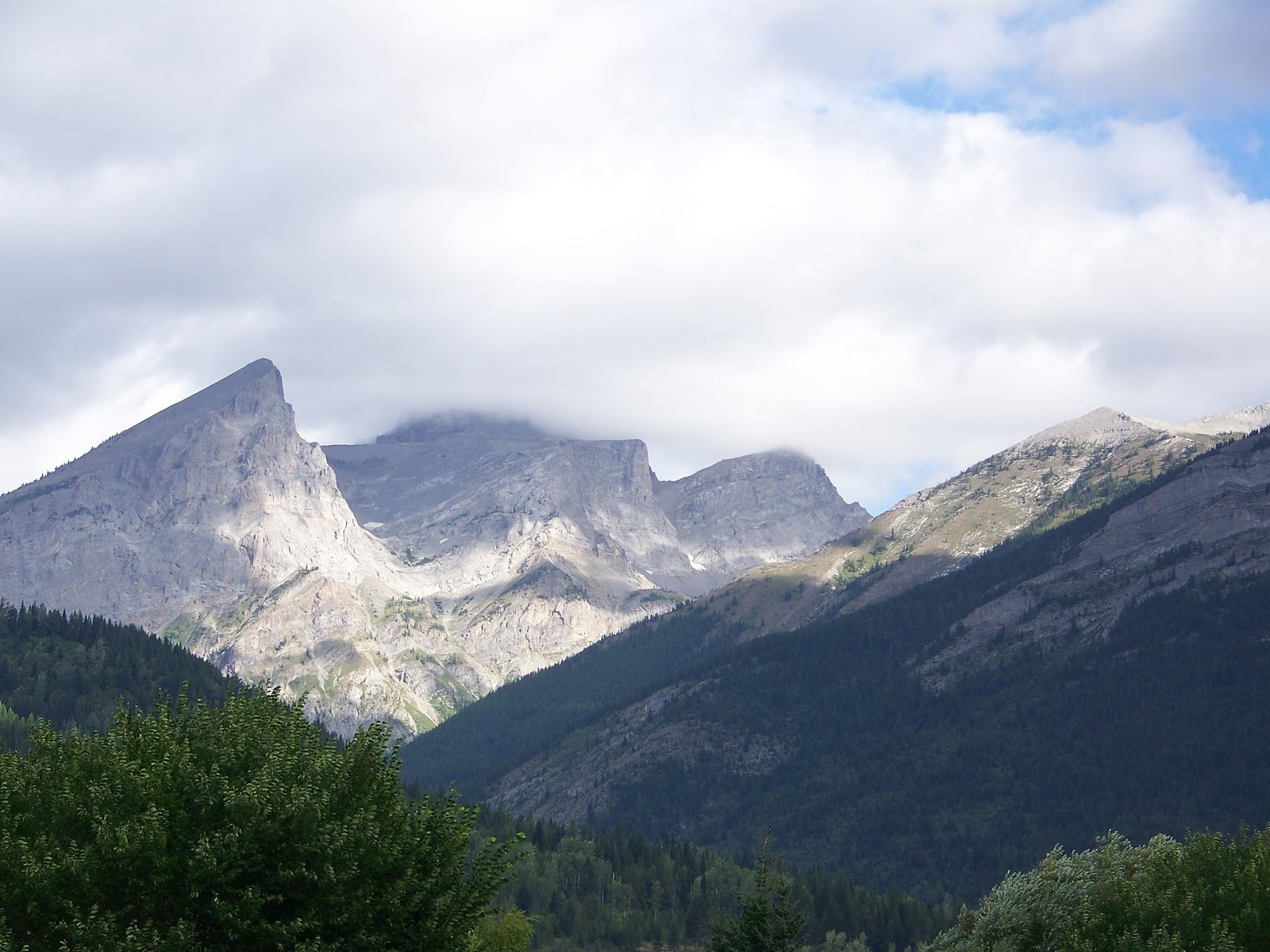 I stopped for just a moment to take a picture in Fernie, of the clouds moving around the mountains.
As I continued to travel north, and the clouds got darker and the air got colder, I thought to myself.
"What am I doing... I'm riding into the storm... There is something wrong with this."
(Scott would be so proud of my complete lack of sanity.)
I stopped for just a moment to take a picture in Fernie, of the clouds moving around the mountains.
As I continued to travel north, and the clouds got darker and the air got colder, I thought to myself.
"What am I doing... I'm riding into the storm... There is something wrong with this."
(Scott would be so proud of my complete lack of sanity.)
I arrived in Sparwood and stopped for fuel, knowing that I didn't have enough to get me to Ft. MacLeod, then, back on the road.
It wasn't long before I rode into Alberta (previously being in British Columbia or "BC").
I stopped at the Information Center for a moment and took a few pictures.
As I continued on my way, I passed several smaller towns spread out along the mountain pass.


Finally reaching Ft. MacLeod around noon, I found a small Bakery/Cafe to each lunch.

 There is a Museum at Ft. MacLeod that is a fort.
However, I chose to only look around the gift shop for a little bit and then be on my way.
(see pic from outside).
I stopped to fill up before leaving town and ended up with a $5 Canadian bill.
I had problems getting my Card to work at the pump and then in an attempt to get rid of some of my Canadian money, (change from lunch) it back fired.
So, I headed south, back towards the US.
There is a Museum at Ft. MacLeod that is a fort.
However, I chose to only look around the gift shop for a little bit and then be on my way.
(see pic from outside).
I stopped to fill up before leaving town and ended up with a $5 Canadian bill.
I had problems getting my Card to work at the pump and then in an attempt to get rid of some of my Canadian money, (change from lunch) it back fired.
So, I headed south, back towards the US.
I stopped at the Dairy Queen in Cardston and used most of that $5 on a large Raspberry shake.
Cardston was the last town before the border, which I reached shortly.
I once again had to answer a few more questions than when Scott and I returned to the US.
When I told the border guard that I was only in Canada for the day, he asked why so much gear.
I had to explain that I have been camping around Montana.
He did let me continue on my way without any unpleasant searches. (Sorry Scott, I know you would have enjoyed reading about that.)

 I rode around the south of Glacier National Park and back up to West Glacier.
I stopped for a bit here to rest a little.
I looked around the Alberta Information Center and took a few pictures. (T-Rex skeleton)
I then walked around the two gift shops that are there at the entrance to town.
This is where I found something that made me think... "Hey, Shawn should do this with his metal stuff."
I came across these antler whistles with a card from "The Antler Works" run by the Lee Hyde family from Afton.
I rode around the south of Glacier National Park and back up to West Glacier.
I stopped for a bit here to rest a little.
I looked around the Alberta Information Center and took a few pictures. (T-Rex skeleton)
I then walked around the two gift shops that are there at the entrance to town.
This is where I found something that made me think... "Hey, Shawn should do this with his metal stuff."
I came across these antler whistles with a card from "The Antler Works" run by the Lee Hyde family from Afton.
Once I was done wandering around, I continued on my way to Big Fork where I stopped at a State Park camp ground and decided that I didn't want to pay $23.
So, I continued on south and stopped at Woods Bay Grill for supper.

 I asked them if there was anywhere I could camp for the night.
The lady called "Outback Montana RV Park Campground" (just around the bend) and they had dry "tent" camp spots for $12.
So, after I finished eating, I went there and found a spot that had the trees I needed, and setup camp.
They also had free Wifi, so I logged in for a little bit, and checked some email.
I found that Shawn had purchased his new site/domain name dracoonline.com.
It was late, so I didn't stay online for long.
I asked them if there was anywhere I could camp for the night.
The lady called "Outback Montana RV Park Campground" (just around the bend) and they had dry "tent" camp spots for $12.
So, after I finished eating, I went there and found a spot that had the trees I needed, and setup camp.
They also had free Wifi, so I logged in for a little bit, and checked some email.
I found that Shawn had purchased his new site/domain name dracoonline.com.
It was late, so I didn't stay online for long.
Aug. 30 2012
Today was a "short" day, so once I had packed and loaded the bike, I stopped at Woods Bay Grill for breakfast.
After breakfast, I filled up at the station next door and then headed south.
I turned off US93 onto highway 212 to cut over to Moiese.
There I stopped to look around the National Bison Range Headquarters.


They have a road that can be driven that takes a couple hours, and you can see a lot of wildlife.
 However, they have a "no motorcycle" policy, because it is all dirt roads, and for safety reasons...
Those bison are BIG and if one or more decided it didn't like me, it wouldn't take much.
The lady did say that I could drive to the end of the paved road where the fishing access is and sometimes there are some Bison down there.
When I got there, there was only this one big guy.
However, they have a "no motorcycle" policy, because it is all dirt roads, and for safety reasons...
Those bison are BIG and if one or more decided it didn't like me, it wouldn't take much.
The lady did say that I could drive to the end of the paved road where the fishing access is and sometimes there are some Bison down there.
When I got there, there was only this one big guy.
I then traveled back to Thompson falls.
I stopped by Ambers, and took many things off my bike and put them on her front porch.
I then connected to her wifi and checked more email and got the web site that I built for Shawn uploaded to dracoonline.com.
I called and left Amber a message saying that I had left some of my stuff on her porch and that I was going to ride up to Noxon. (She was still at work.)
I took Blue Slide Road north, instead of going to MT200.
It was a fun road to ride.
There were a few spots that got bumpy and narrow.
And there was a section that was dirt/gravel. (Ok, it was only like 50 to 100 feet, I'm guessing.)
But I did think it was odd to have such a small section unpaved.
Anyway, Blue Slide met back up with MT200 just north of Trout Creek, and I continued on that until Noxon.

Actually, A little before Noxon is the Noxon Rapids Hydro Dam.
I made a short stop here for a picture.

Now, I don't know how many horses they have in this little town, but it is a one lane bridge town.
That happens to have a big nest on it.
I rode over and stopped at what looked like the only store.
The Noxon Mercantile.


On the side of the Mercantile was a line of nests.
Inside, I purchased a Huckleberry Cream Soda.

Across the street, there is a park that has the Gary Nelsen Memorial Pavilion.
And own in the middle of the river, was a big log with a bald eagle ruffling its feathers.

 Once I finished my soda, I headed back to Thompson falls.
Knowing that Amber would not be home yet, I rode into town to look around.
As I pulled over at the side of the road, Amber was just driving by and honked.
She turned around and we chat for just a minute, as she needed to go get Amara to get her to a meeting with her teacher.
Once she left, I wandered around a bit.
Taking the bike, I went off the main road to see if they had anything else in town.
All I saw was residential.
I did ride up to the hills a little, until I reached the Silcox and Headly trail head.
Once I finished my soda, I headed back to Thompson falls.
Knowing that Amber would not be home yet, I rode into town to look around.
As I pulled over at the side of the road, Amber was just driving by and honked.
She turned around and we chat for just a minute, as she needed to go get Amara to get her to a meeting with her teacher.
Once she left, I wandered around a bit.
Taking the bike, I went off the main road to see if they had anything else in town.
All I saw was residential.
I did ride up to the hills a little, until I reached the Silcox and Headly trail head.

 As I rode back into town, I came upon the school.
And there was a herd of deer eating the grass or laying in the shade.
As I rode through the houses in the area, there were several other deer.
Some spikes and forkies and one or two a little bigger, all still in velvet.
As I rode back into town, I came upon the school.
And there was a herd of deer eating the grass or laying in the shade.
As I rode through the houses in the area, there were several other deer.
Some spikes and forkies and one or two a little bigger, all still in velvet.
A little bit later, Amber called and we met at the Cafe for supper.
Where there was enough water spilled to solve the drought in Africa.
At one point, the waitress referred to me a "dad" and Akery said, he's not our dad, he's our Aaron.
After supper, I had parked right outside, but Amber was down about a block.
I started the bike and walking it down the street alongside, so Amara and Akery decided they needed a ride.
I wasn't sure, but Amber said it was ok.
I put Amara behind me, and Akery in front, and rode slowly off the side of the rode the half block to the suburban.
We got a couple waves.
Once we got the kids strapped in, we headed back to Ambers.
I put the pictures from the day on the laptop and worked on getting then renamed so I would know what they were.
As all was settling down for the night, Akery came to me and said she was having a hard time going to sleep.
So, I finished getting ready for bed, and we curled up on the couch and went to sleep.
At about 2-2:30 she woke up and wanted a drink.
I got her a drink and she took one drink and she was done.
She decided that she would sleep on the love seat the rest of the night.
Aug. 31 2012
Amber had to head to Lewiston/Clarkson/Pomeroy so we got up early.
We got the kids in the rig, and they were off a little after six.
I was planning on taking a hike before heading back, but I just wasn't feeling it.
I let it warm up outside a little bit as I got the bike loaded up.
While I was loading, I did notice that under the steps was the black bunny.
Both bunnies had escaped a few days earlier.
There was no catching it, so I opened the gate to the hutch thinking maybe they will go in for water.
I guess Amber will see if it worked when she gets home.
Once I was all loaded up, I headed back.
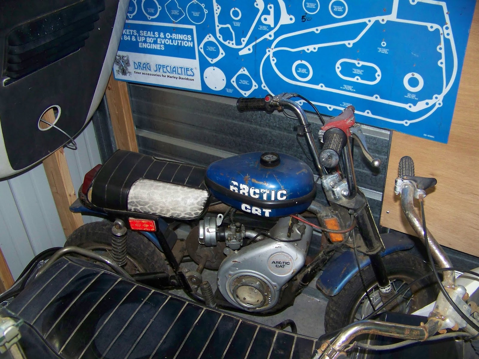
When I got to Kingston, I stopped to see the "Motorcycle Museum".
Turns out, it is a storage locker converted into a Motorcycle display.
I guess it was still kind of cool though.


And who knew Artic Cat made motorcycles, and Harley Davidson made snowmobiles.

Going home, I again, went through St. Maries, although, instead of going through Santa, Clarkia and Bovill, I went through Harvard, Yale, Stanford and Vassar.
Trip Information: Distance=1496.19 Miles. Duration: Riding=44h 40m 26s Total Trip=5 1/2 days
And thus ends another episode of AJ's Crazy Biker Adventures.
Join us next time for "Is that a Mack in my lane?"